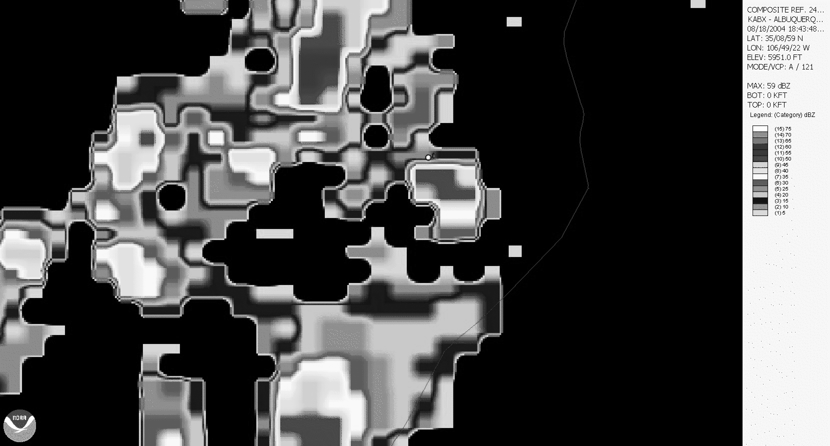
Animated gif giving NOAA radar images in 5 minute intervals between 1843 UT and 2044 UT for a thunderstorm of August 18, 2004. White dot in the image is location of Langmuir Laboratory.
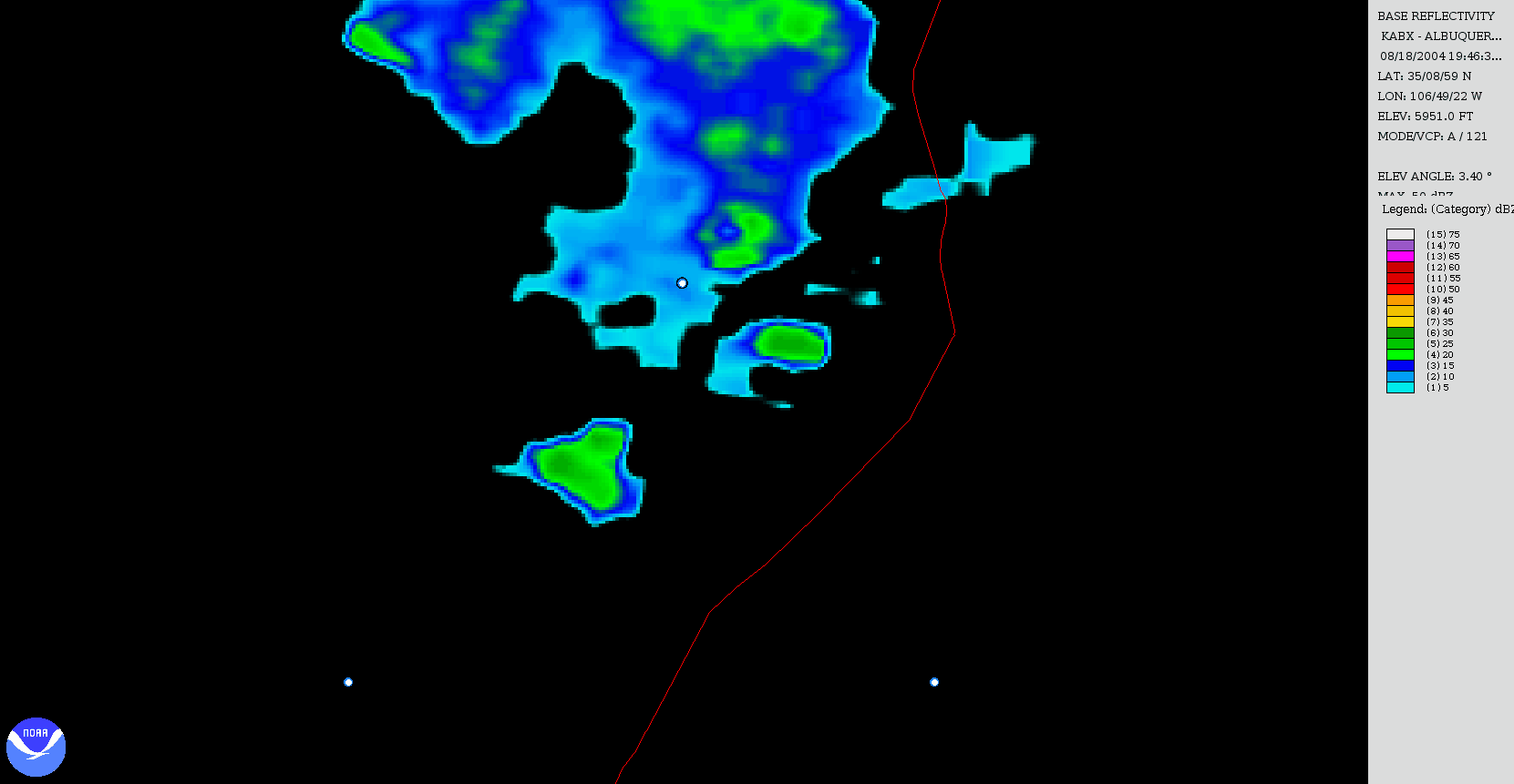
Animated gif giving NOAA N3R radar images in 5 minute intervals between 1946 UT and 2044 UT. The northern white dot is the location of Langmuir Laboratory. The southern white dots are separated by 60 km.
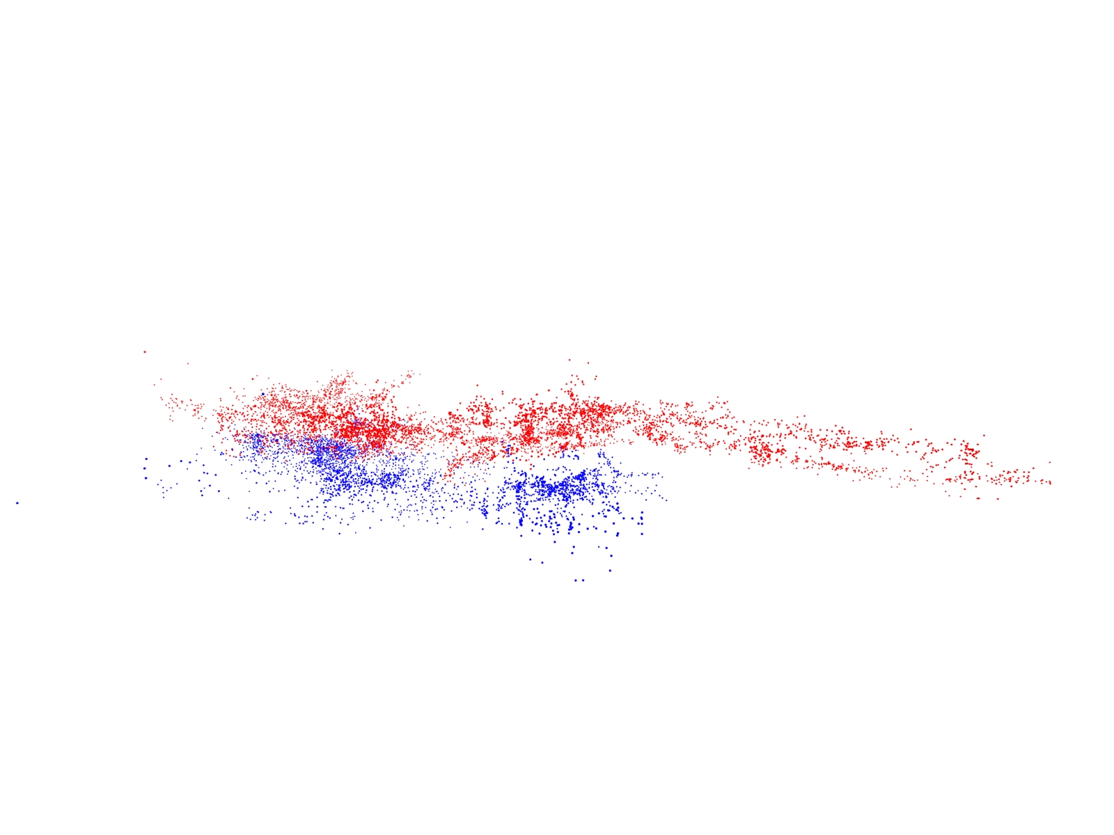
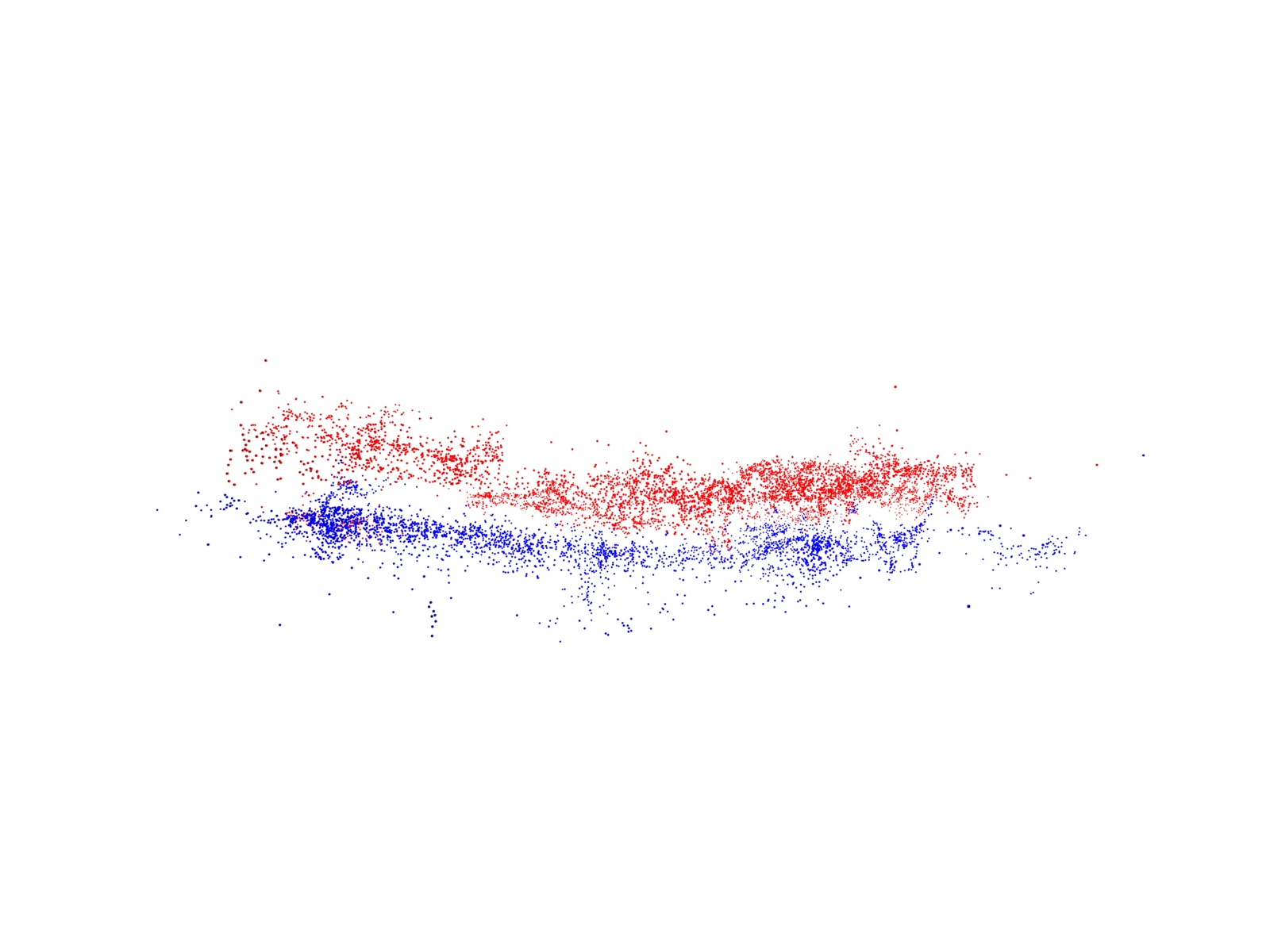
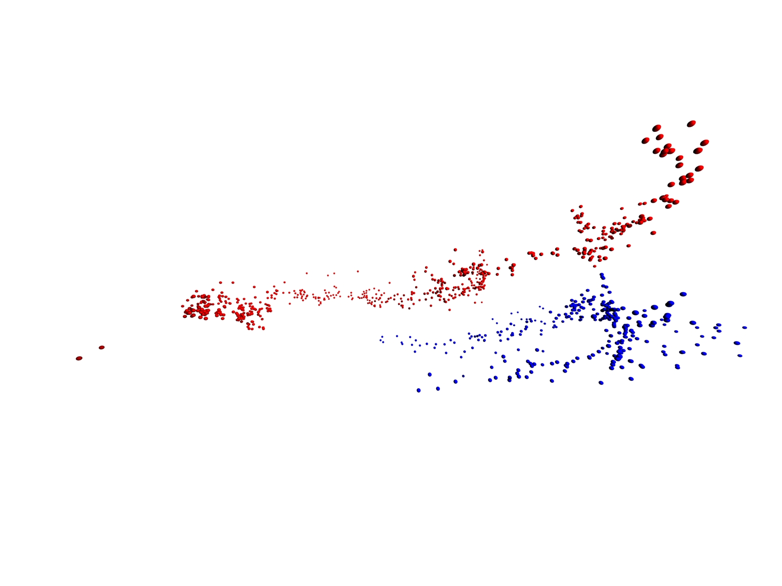
Location of cameras for side views of LMA pulses of storm
Animation Camera starts from top of storm pointed down with top of camera looking northwest. The camera rotates from the top to the eastern side of the storm and then makes a 360 degree counter clockwise rotation around the storm. This is a gzipped avi file which should be downloaded to your computer for viewing.
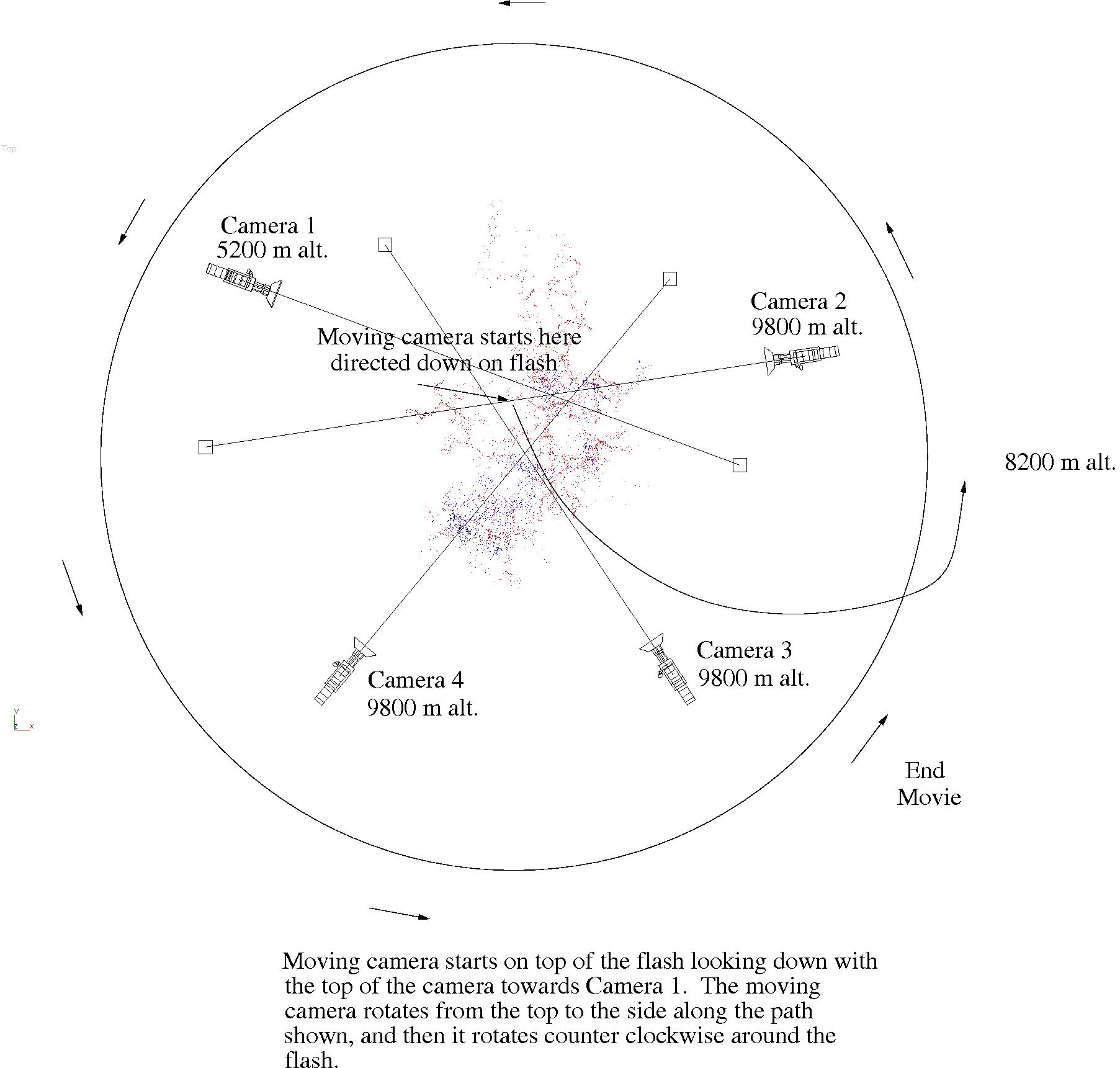
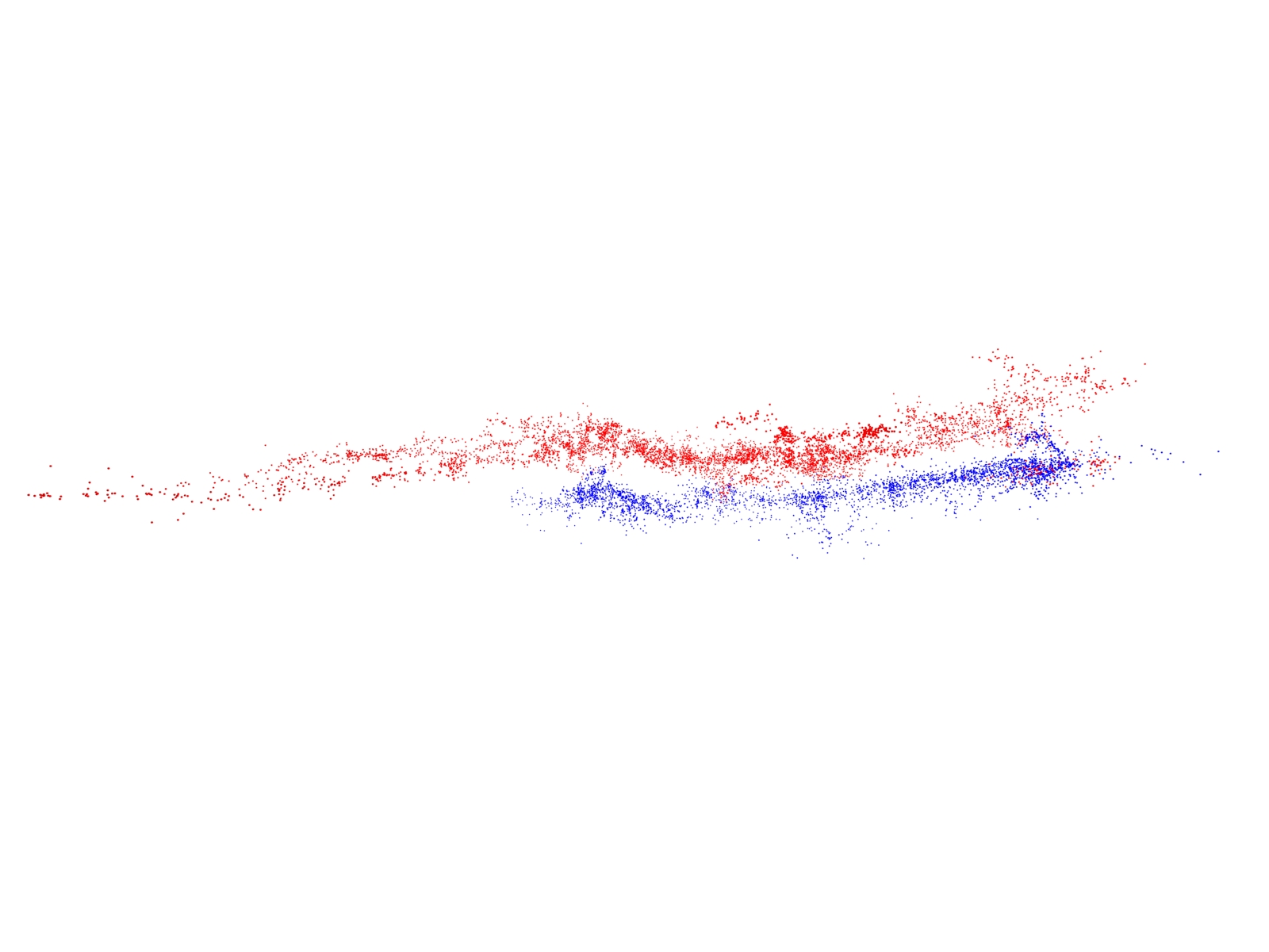
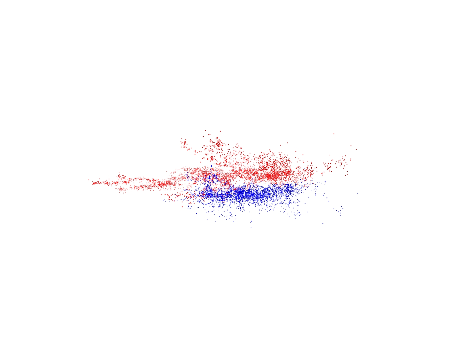
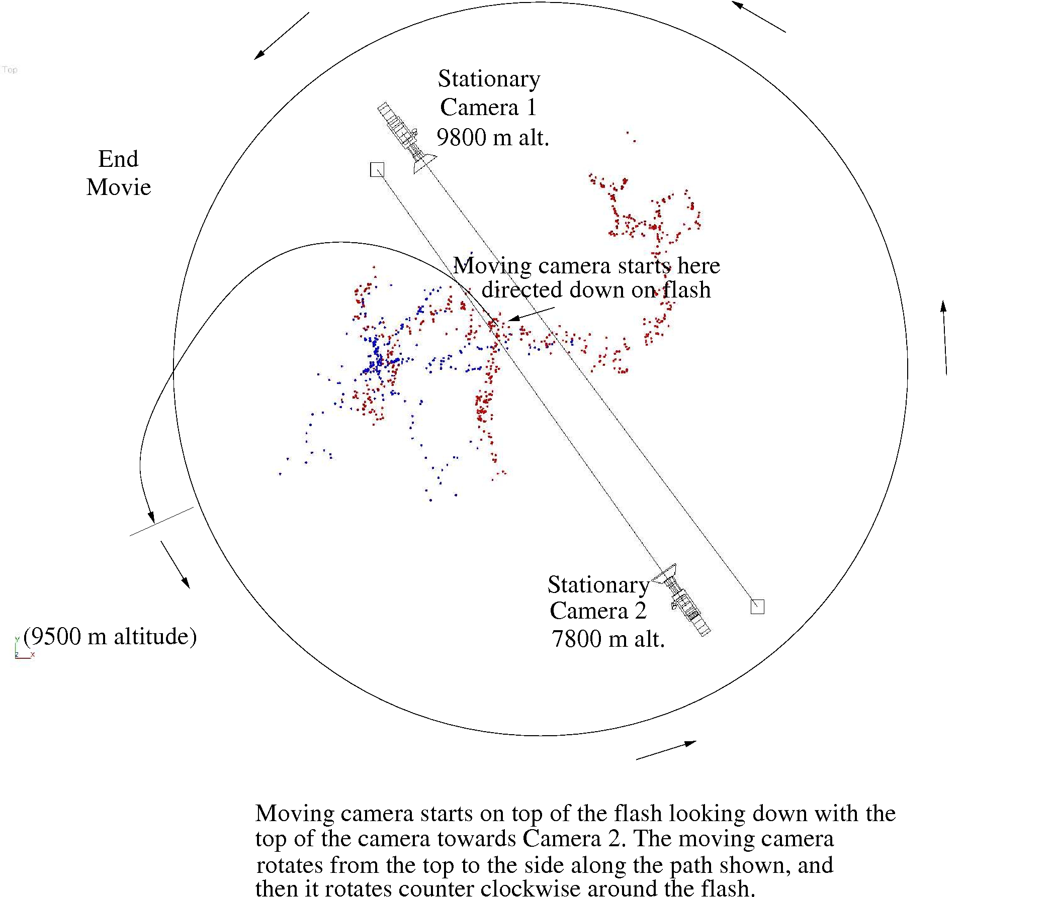
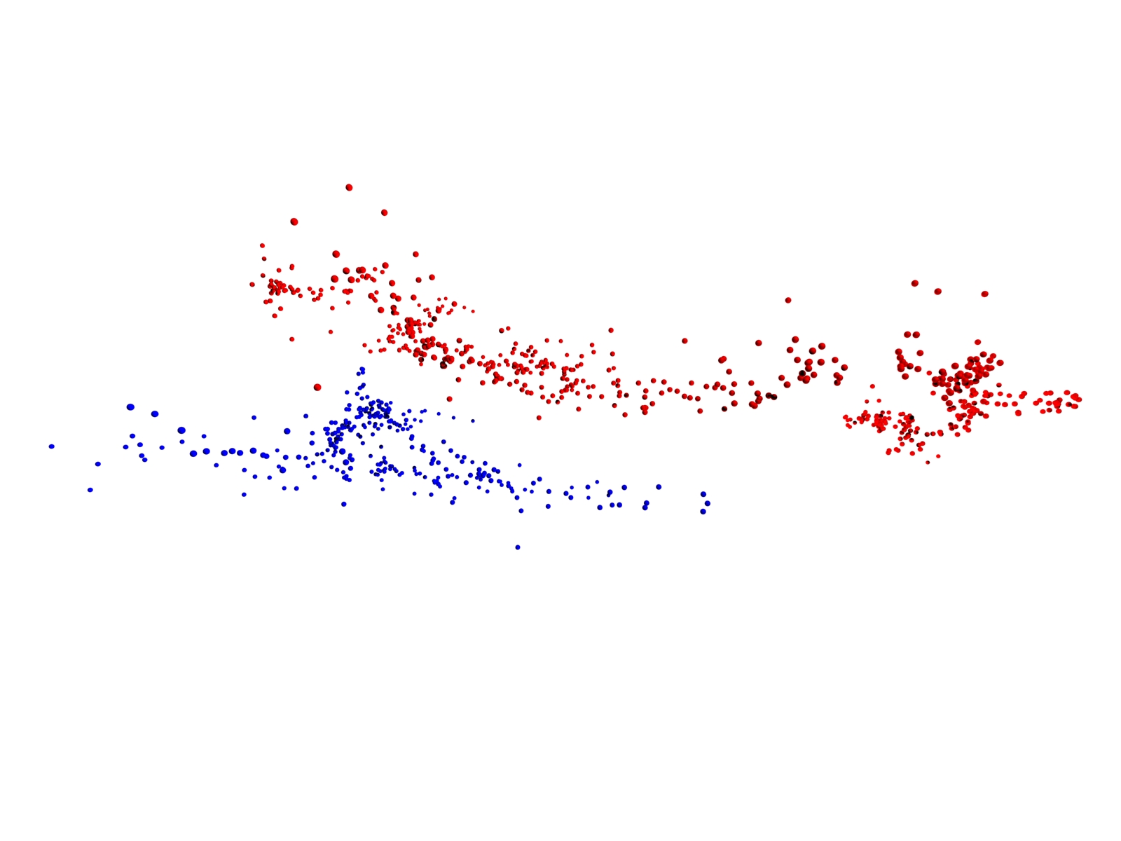
Location of cameras for side views of LMA pulses for Flash 2
Animation Camera starts from top of flash pointed down with top of camera looking southeast. The camera rotates from the top to the western side of the flash and then makes a 360 degree counter clockwise rotation around the flash. This is a gzipped avi file which should be downloaded to your computer for viewing.